Quoting from IMPRESSIONS - An Artist's Introduction To Killarney Provincial Park..........
Were you to hike
the entire La Cloche Silhouette Trail loop, the Hansen Township section would
lead you to Silver Peak. At 539 meters above sea level, it is the highest point
in the La Cloche Range. On a clear day the panoramic view, which takes in the
entire park area, is breathtaking. The City of Greater Sudbury can be seen 45
kilometers to the northeast, as well as much of Georgian Bay to the southwest.
There’s scarcely an artist that, although a bit overwhelmed by the view, isn’t
inspired to attempt a sketch or two.
For those who
choose not to hike the La Cloche Silhouette Trail loop, don’t despair for there
is a way to reach Silver Peak without hiking and backpacking for several days.
Silver Peak can also be reached in a single day. A cautionary note, however.
This is a long one-day trek and shouldn’t be undertaken without proper
preparation.
My wife, Sandy,
and I undertook to make the trek on one occasion. I was approaching my mid
sixties and beginning to feel a bit creaky so I decided one day in late July
that the time had come to challenge the peak. There’s no easy way to get to
Silver Peak let alone climb to the top. We chose to drive in to the Bell Lake
access point and then to paddle to its western inlet to pick up the trail. As
we begun our trek, the day held promise. It was warm and the sky was clear. As
we set off in the canoe, there was a light breeze in our face. That summer had
been an exceptionally bad year for mosquitoes. One would have thought, however,
that by late July the worst
 |
Bell Lake with Silver Peak in the background.
Graphite Drawing |
would have passed, but no sooner did we touch the
far shore a cloud of blood-thirsty mosquitoes descended upon us. We quickly
pulled the canoe ashore and set it in the bushes out of the way. We then raced
off along the trail with the mosquitoes in hot pursuit. Despite the fact that
it was very warm, bordering on hot, we wore our jackets with the hoods pulled
up to avoid being bitten. By the time we reached the turn off leading to the
peak, we had managed to leave the mosquitoes behind. Tired, we began the ascent
to the top. I’d be lying if I didn’t say that the trail to the top is
challenging. However, it was with a sense of pride that we climbed steadily and
overtook, and passed, a group of younger hikers who were huffing and puffing at
only the half way point. By noon, the temperature had increased by a few
degrees so it was with some relief that we broke out of the trees and climbed
into the bright sunlight near the top of the peak. A wonderful breeze was
blowing that stiffened into a bit of a gale as we approached the top.
 |
View fromSilver Peak Pen and Ink Drawing |
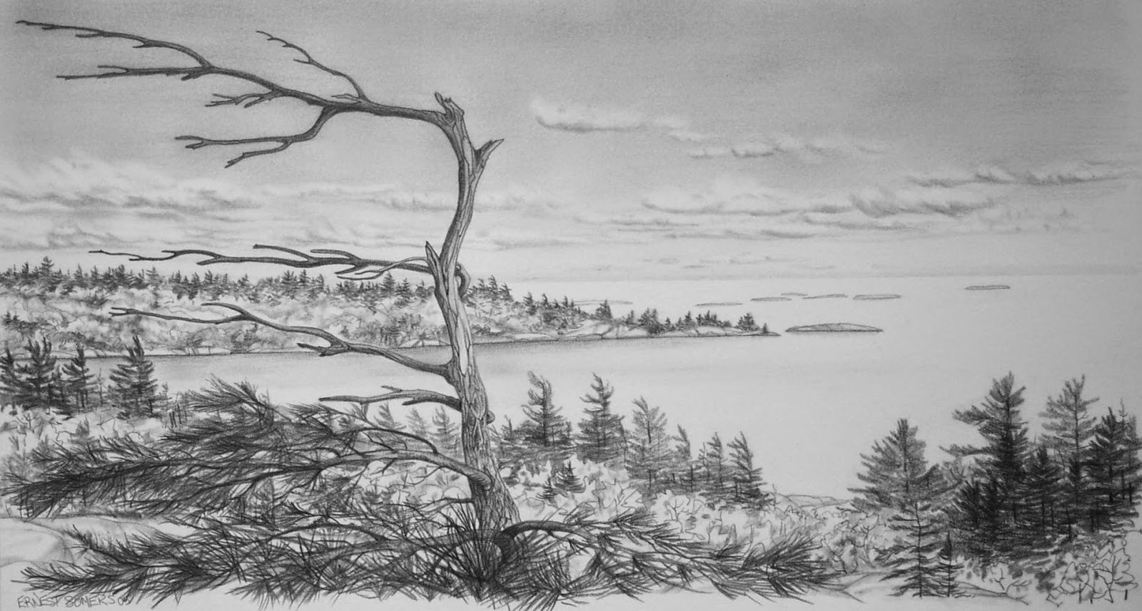
The view
from the peak was awesome. There was Sudbury to the northeast and Georgian Bay
to the southwest. As we had been told to
expect, we could almost see the entire park. It was worth the climb and the
inconvenience caused by the hoards of mosquitoes. However, we were, to say the
least, a bit exhausted. It had taken us more than three hours of paddling and
hiking at a brisk pace to reach the top and the thought that we now had to
retrace our steps was a bit daunting. I made a couple of quick sketches, took
some photographs, then sat and rested in complete awe of the scene that lay
before me. Rested, and with the afternoon shortening, we decided to descend and
head back to our canoe. Fortunately, during the hike back the mosquitoes were
no bother and it seemed as though in no time at all we were back in the canoe
and out on the lake.........with the wind, once again, brushing our face.
There’s an interesting phenomena about canoeing. One can set off on a paddle
with the wind in your face thinking that the paddle back will be easy as the
wind will be at your back, right? Why does it never seem to work out like this?
Perhaps it is God’s way of testing canoeists! A little wind is the canoeist’s
friend. It makes the canoe handle easier. A full force gale which turns the
lake into a frothy mess of whitecaps, however, tends to cause the stomach to
lurch just a bit. This is what we faced when we hit the open stretch just off
Blue Mountain Lodge. With no way around it, we headed out and up the lake into
the waves until, in the middle of the lake at an opportune moment, we swung
around and headed down the lake surfing all the way to the shore. As I pulled
myself out of the canoe and took a moment or three attempting to straighten up,
I thought to myself that this day had been a fantastic experience. I also
thought that it was good that we did what we did because next year Silver Peak
was bound to be just that much higher!

View from Silver Peak Graphite Drawing
 |
View from Silver Peak Pen and Ink Drawing
|
A View from Silver Peak Graphite Study
View North from Silver Peak Graphite Drawing
Well, time to climb down from Silver Peak. Next time out we'll wander by the Bay and visit the Chikanishing Trail and George Island where we'll finish up our visit to Killarney Provincial Park..................